Support for InfrastructureUSA.org
has been provided by these organizations and individuals:

John Hennessy III,
P.E.

Posts Tagged ‘Texas Transportation Institute’

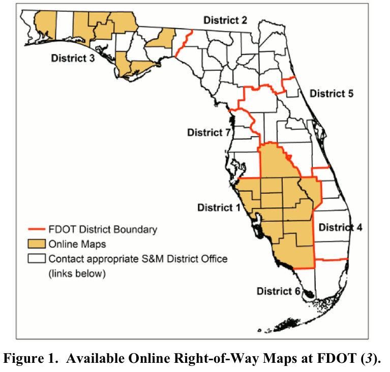
Optimizing the Management of Right-of-Way Parcel and Utility Information at FDOT

Monday, May 27th, 2013
View full report (PDF): Strategic Plan to Optimize the Management of Right-of-Way Parcel and Utility Information at FDOT

TEXAS TRANSPORTATION INSTITUTE
The Florida Department of Transportation (FDOT) is responsible for the safe operation and management of thousands of miles of highways. More than 12,000 centerline miles are on- system miles, of which roughly half are located in urban areas (i.e., areas with a population of at least 5,000) (1). This total includes 456 centerline miles that are part of the Florida Turnpike Enterprise.

View this complete post...

Urban Mobility Report

Tuesday, February 26th, 2013

TEXAS TRANSPORTATION INSTITUTE
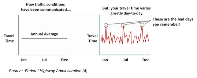
The data behind the 2012 Urban Mobility Report are hundreds of speed data points on almost every mile of major road in urban America for almost every 15-minute period of the average day. For the congestion analyst, this means 600 million speeds on 875,000 thousand miles across the U.S. – an awesome amount of information. For the policy analyst and transportation planner, this means congestion problems can be described in detail and solutions can be targeted with much greater specificity and accuracy.

View this complete post...

New Approaches for U.S. Lock and Dam Maintenance and Funding

Thursday, January 10th, 2013

TEXAS TRANSPORTATION INSTITUTE
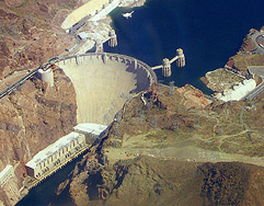
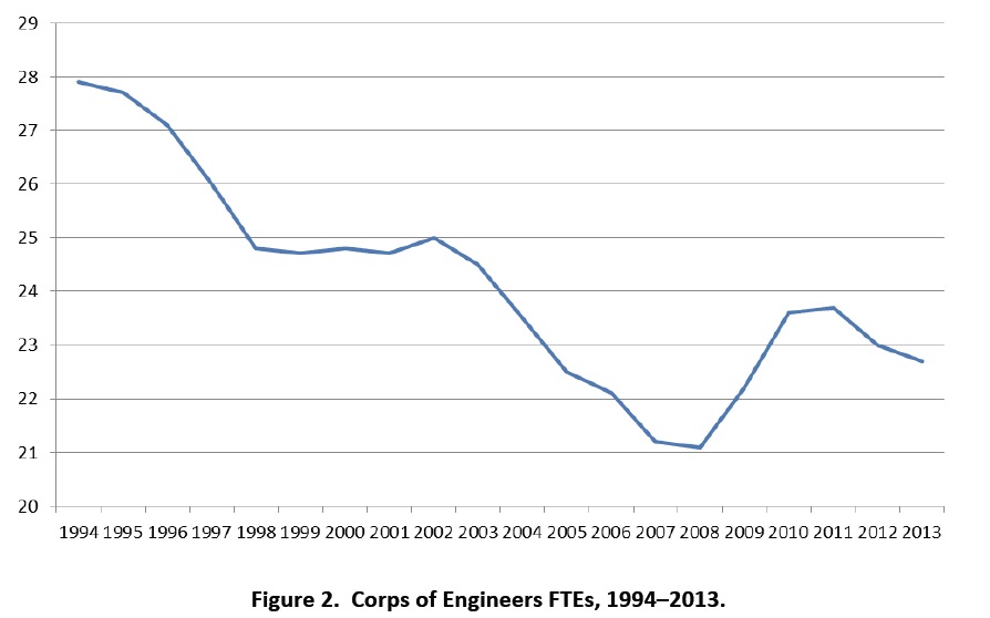
The U.S. Army Corps of Engineers (Corps) is responsible for building and maintaining much of the federal water resources infrastructure in the nation and is responsible for construction and maintenance of navigation projects on 12,000 miles of river channels that comprise 27 inland river systems, and 207 lock chambers at 171 lock sites.

View this complete post...

2011 Congested Corridors Report

Wednesday, November 16th, 2011
screen-shot-2011-11-16-at-110714-am

Congestion is a significant problem in America’s urban areas. This is well documented in the
Texas Transportation Institute’s Urban Mobility Report. Powered by 2010 INRIX traffic data,
the 2011 Congested Corridors Report includes analysis along 328 specific (directional) freeway
corridors in the United States. These corridors include many of the worst places for congestion
in the United States, and the detailed data allow for more extensive analysis and a better picture of the locations, times and effects of stop-and-go traffic. The report doesn’t list every bad location for congestion, but the issues explored here advance the understanding of when, how and where congestion occurs.

View this complete post...

Congestion Data for Your City

Thursday, October 13th, 2011
Congestion Data for Your City

TEXAS TRANSPORTATION INSTITUTE
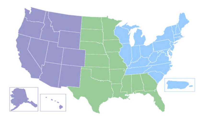
Each regional map has dots linking to a file containing the Urban Mobility and Congestion Statistics—congestion index, travel delay, fuel consumption, congestion cost—for every city included in the study. The files are in PDF format. You can get the numbers—all the numbers—for each of the 101 cities. You can also view the national congestion tables which provide comparison measurements for all 101 cities included in the study.

View this complete post...

Urban Mobility Report 2010

Wednesday, January 26th, 2011
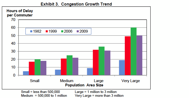
Congestion Growth Trend

TEXAS TRANSPORTATION INSTITUTE

View this complete post...

DRIVEN APART: How Sprawl Is Lengthening Our Commutes and Why Misleading Mobility Measures Are Making Things Worse
Thursday, September 30th, 2010
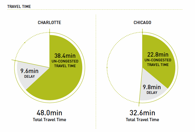
Charlotte vs. Chicago

CEOs for Cities
The secret to reducing the amount of time Americans spend in peak hour traffic has more to do with how we build our cities than how we build our roads. While peak hour travel is a perennial headache for many Americans — peak hour travel times average 200 hours a year in large metropolitan areas — some cities have managed to achieve shorter travel times and actually reduce the peak hour travel times. The key is that some metropolitan areas have land use patterns and transportation systems that enable their residents to take shorter trips and minimize the burden of peak hour travel.

View this complete post...

Follow InfraUSA on Twitter Facebook YouTube Flickr

CATEGORIES


Show us your infra! Show us your infra!

Video, stills and tales. Share images of the Infra in your community that demands attention. Post your ideas about national Infra issues. Go ahead. Show Us Your Infra!  Upload and instantly share your message.

Polls Polls

Is the administration moving fast enough on Infra issues? Are Americans prepared to pay more taxes for repairs? Should job creation be the guiding determination? Vote now!

Views

What do the experts think? This is where the nation's public policy organizations, trade associations and think tanks weigh in with analysis on Infra issues. Tell them what you think.  Ask questions.  Share a different view.

Blog

The Infra Blog offers cutting edge perspective on a broad spectrum of Infra topics. Frequent updates and provocative posts highlight hot button topics -- essential ingredients of a national Infra dialogue.


Dear Friends,


It is encouraging to finally see clear signs of federal action to support a comprehensive US infrastructure investment plan.


Now more than ever, our advocacy is needed to keep stakeholders informed and connected, and to hold politicians to their promises to finally fix our nation’s ailing infrastructure.


We have already engaged nearly 280,000 users, and hoping to add many more as interest continues to grow.


We require your support in order to rise to this occasion, to make the most of this opportunity. Please consider making a tax-deductible donation to InfrastructureUSA.org.


Steve Anderson

Managing Director


SteveAnderson@InfrastructureUSA.org

917-940-7125

InfrastructureUSA: Citizen Dialogue About Civil Infrastructure