


TEXAS TRANSPORTATION INSTITUTE
Introduction
The Florida Department of Transportation (FDOT) is responsible for the safe operation and management of thousands of miles of highways. More than 12,000 centerline miles are on- system miles, of which roughly half are located in urban areas (i.e., areas with a population of at least 5,000). This total includes 456 centerline miles that are part of the Florida Turnpike Enterprise.
By all accounts, FDOT manages a huge right-of-way (ROW) asset. Managing this asset involves considerable resources and linkages to numerous business processes. Examples of core processes related to the right-of-way asset itself include determining right-of-way boundaries; inventorying roadside features; preparing right-of-way maps; buying, selling, and leasing assets; regulating the accommodation of utilities within the right-of-way; and preparing reports documenting right-of-way assets. Ready access to related information, as is the case for other core data at FDOT, is a key requirement not just for streamlining project delivery but also throughout the life cycle of transportation infrastructure facilities.
Central to this effort is FDOT’s enterprise geographic information system (GIS) initiative. While FDOT has used GIS for years, concerns about the lack of data integration and coordination resulting in redundant data storage and ineffective workflows prompted FDOT to develop an enterprise GIS framework to enable data and technology sharing between the FDOT Central Office and district offices. In 2008, FDOT completed a report that provided recommendations for that framework, which included the following definition of an
enterprise GIS:
Enterprise GIS is an organization-wide framework for Department communication and collaboration of shared geospatial data and GIS resources that enhances existing business processes and provides an efficient way to plan, analyze, and manage transportation infrastructure and related elements.
Of the four framework options studied in the 2008 report, the report recommended Option 3 (a distributed enterprise GIS with enterprise standards). The report included the results of an analysis of data flows within core functional areas, including planning, environmental management, design, construction, maintenance, operations, and materials. Right-of-way and utility data issues were not focal points of the analysis, although indirect references to those issues highlighted items such as the need to improve the digitalization of parcels and right-of- way maps and inefficiencies in the depiction and extraction of utility features.
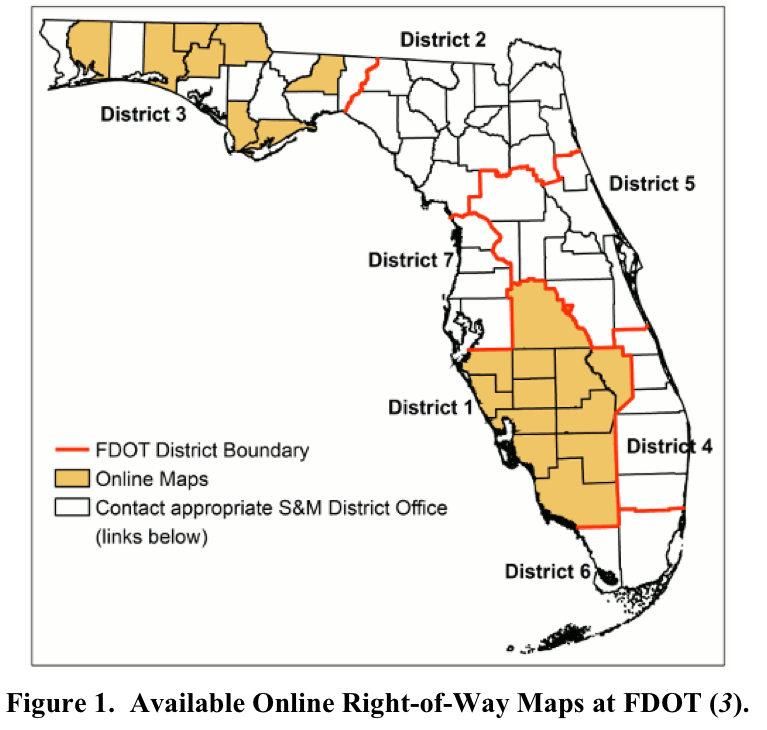
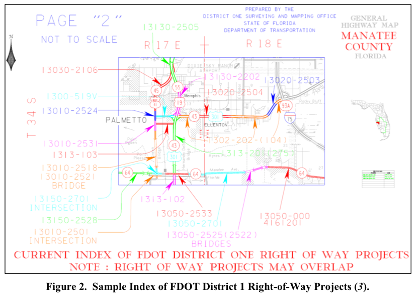
FDOT would like to incorporate right-of-way parcel and utility data into its existing enterprise GIS system. Currently, FDOT has multiple portals that serve portable document format (PDF) files of right-of-way maps in the Central Office and District Offices. Figure 1 shows districts where online right-of-way maps are available, according to information gathered from the FDOT website. Figure 2 shows a sample index of FDOT right-of-way projects in Manatee County (District 1).
About the Texas Transportation Institute
tti.tamu.edu
The Texas A&M Transportation Institute (TTI), a member of The Texas A&M University System, seeks solutions to the problems and challenges facing all modes of transportation. TTI works on over 600 research projects with over 200 sponsors annually at all levels of government and the private sector. TTI is recognized as one of the finest higher education-affiliated transportation research agencies in the nation and helps prepare students for transportation careers
Tags: FDOT, parcel, right-of-way, Texas Transportation Institute, utility
 RSS Feed