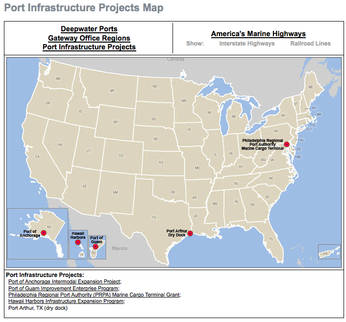
According to a U.S. DOT Report on freight traffic, the number of trucks on our highways will more than double by 2035. Inland waterways, or “marine highways,” could reduce congestion by taking on some of the freight burden.
To make the port-and-waterway system more familiar, the U.S. Maritime Administration offers an interactive map, with information on current maritime infrastructure projects around the U.S. The map also shows inland waterways, interstate highways, railroads, and port locations around the country.
View this complete post...







 RSS Feed