STREETSBLOG
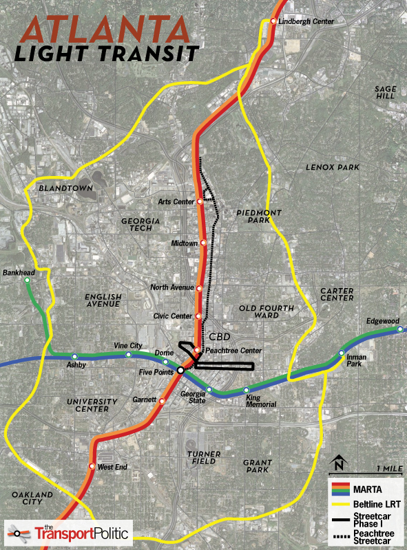
For years, the city of Atlanta has been developing ambitious plans to connect its radial transit lines with a circular “beltline.” As envisioned, the $2.8 billion project would include 22 miles of light rail and recreational amenities, circling the central city, taking advantage of existing freight lines. For now, however, those plans are getting less attention from city leaders than a 2.6-mile streetcar line that would serve as an east-west connector for downtown.


 RSS Feed