SAVE OUR BRIDGES
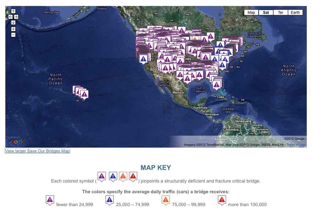
By accessing the Save Our Bridges Map, users can enter a zip code to immediately see the dangerous bridges in their area. Families can see if their children’s school buses or their own commutes to work or church take them across a bridge that is both structurally deficient and fracture critical. Trucking companies and other suppliers can determine whether the routes their carriers take require that they cross these dangerous bridges.
Features of the Map
The map covers all 50 states. By clicking on a particular icon, one can readily see information taken from the Federal Highway Administration and state transportation agencies describing when the particular bridge was built, how much daily traffic crosses the bridge, and other pertinent information about its structure. Also, by clicking on “Street View,” for many of the featured bridges, users can go from a map view of the area around a bridge to an actual photograph of the bridge.
View Interactive Map (SaveOurBridges.com): Save Our Bridges
About the Save Our Bridges Map
www.saveourbridges.com
“Save Our Bridges is an interactive map which allows the public to easily locate bridges in their area that are classified as both structurally deficient and fracture critical.
Created by Barry B. LePatner, lawyer and author of Too Big to Fall: America’s Failing Infrastructure and the Way Forward (University Press of New England, 2010), the intention of the map is to raise public awareness of the state of America’s infrastructure by pinpointing hazards close to home.”
Tags: Federal Highway Administration, Interactive Map, Save Our Bridges


 RSS Feed