OPENLANDS PROJECT
CENTER FOR NEIGHBORHOOD TECHNOLOGY
What is Green Infrastructure?
Green infrastructure is the interconnected network of land and water that supports native species, maintains natural and ecological processes, sustains air and water resources, and contributes to the health and quality of life of people and communities.
The need to protect the region’s green infrastructure is greater than ever. Rapid changes in land use, increases in non-native species, and other threats imperil the region’s natural heritage. Green infrastructure should serve as the strategic framework for conservation and development so that linkages and key natural areas can be preserved before development occurs.
Green infrastructure can range in size from the intimate to the vast, from a small neighborhood garden to Lake Michigan. Each piece has its place in the regional fabric. Understanding the relationship between the pieces is important because it will provide a framework for protecting and restoring natural landscapes.
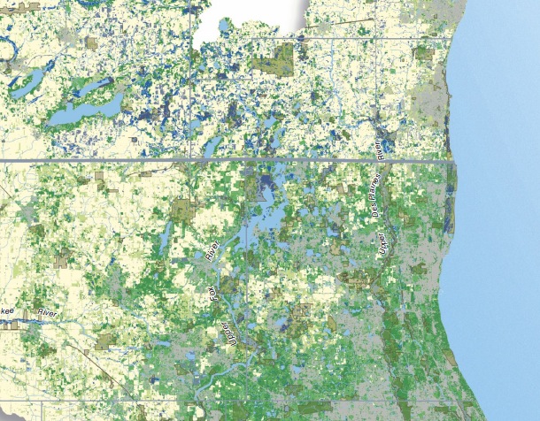
This map uses sub-watershed boundaries for its borders to illustrate how the regional fabric of green infrastructure stretches across state and county lines, ignoring political boundaries.
The region’s green infrastructure is characterized by rich natural resources, globally rare ecosystems, and tremendous biological diversity. It also has immense economic value – e.g., wetlands that reduce fl ooding, trees that cool neighborhoods in the summer, and open spaces that absorb rainwater and replenish the aquifer. All provide millions of dollars worth of benefits to the region each year.
How to Use This Map
This map can be used as a tool for creating linkages between existing protected lands and for identifying opportunities for natural resource protection and restoration. As the map shows, the region has vast green infrastructure resources, but only a limited amount is currently protected and many protected areas are isolated from each other. Strategically focused efforts to protect more green infrastructure and create new linkages are crucial.
Read more about the project and view additional maps: www.greenmapping.org
Download full map (PDF): Natural Connections
About the Openlands Project
www.openlands.org
“Openlands protects the natural and open spaces of northeastern Illinois and the surrounding region to ensure cleaner air and water, protect natural habitats and wildlife, and help balance and enrich our lives. Openlands’ vision for the region is a landscape that includes a vast network of land and water trails, tree-lined streets, and intimate public gardens within easy reach of every city dweller. It also includes parks and preserves big enough to provide natural habitat and to give visitors a sense of the vast prairies, woodlands, and wetlands that were here before the cities. In sum, Openlands believes that protected open space is critical for the quality of life of our region.”
About the Center for Neighborhood Technology
www.cnt.org
“Founded in 1978, the Center for Neighborhood Technology is a leader in promoting more livable and sustainable urban communities. In fact, our work focused on sustainable development before the term became as popular as it is today. As a creative think-and-do-tank, we research, invent, and test urban strategies that use resources more efficiently and more equitably.”
Tags: Center for Neighborhood Technology, CNT, IL, Illinois, IN, Indiana, Openlands Project, WI, Wisconsin



 RSS Feed