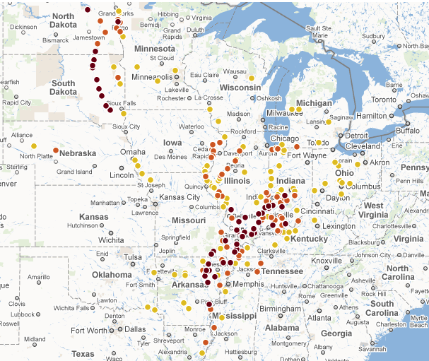
An interactive map from the Wall Street Journal displays the severity of the flooding currently happening in the US Midwest, where “Monday evening, the Ohio River gauge at Cairo read 61.44 feet, nearly two feet higher than the record of 59.51 feet set in 1937.”
More information from the Wall Street Journal
Tags: Bird's Point Levee, Cairo, Illinois, Interactive, Ohio River, US Army Corps of Engineers, Wall Street Journal


 RSS Feed
Since when do maps have Penn Hills, PA instead of Pittsburgh?